

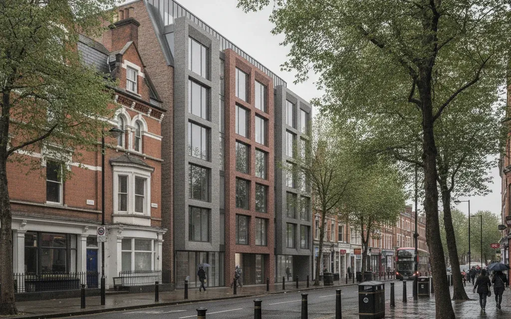
Verified Views and AVRs: What Planning Applications Actually Require
A verified view, formally an Accurate Visual Representation (AVR), is an image of a proposed building produced to a documented, auditable methodology: the camera position is surveyed, the lens and height are recorded, and the 3D model is placed by coordinates rather than by eye. A planning committee can trust it in a way it cannot trust a marketing render, because every step from photograph to final image can be checked. That is the whole point, and it changes how the image is briefed, produced and priced.
What makes a view "verified"?
The photograph and the CGI are locked together by measurement, not judgement. A surveyor records the exact camera position, usually with GNSS or a total station, along with the camera height, the lens focal length and the capture time. The 3D model of the proposal sits in real-world coordinates, and reference points visible in the photograph (parapets, chimneys, kerb lines) are used to confirm the camera match. The output ships with a methodology statement, so an officer, an inspector or an objector can retrace how the image was made.
Image quality is not what earns the word verified. A beautiful render with an estimated camera position is still an unverified image; a plain wireline with a surveyed one is still evidence. We produce both marketing CGI and verified views as part of our architectural CGI for planning work, and the discipline is different: one sells a scheme, the other defends it.
What do the AVR levels 0 to 3 mean?
The levels come from the London View Management Framework and describe how much the image commits to showing:
- AVR 0: location and size of the proposal, typically a wireline outline over the photograph.
- AVR 1: location, size and degree of visibility, so obstructions in front of the scheme are resolved.
- AVR 2: adds architectural form, a massing-accurate but not photoreal representation.
- AVR 3: adds materials, a fully rendered image that still sits on the surveyed camera match.
The level is a brief decision, not a quality tier. An AVR 3 costs more because the CGI work is deeper, but many townscape consultants ask for AVR 1 wirelines precisely because they argue visibility without arguing taste.
When does a planning application need verified views?
There is no blanket rule; the trigger is policy. In London, the classic case is a scheme that enters one of the protected vistas in the London View Management Framework, the panoramas and river prospects around St Paul's Cathedral, the Palace of Westminster and the Tower of London. Outside those corridors, verified views are routinely requested for tall buildings, for development in or near conservation areas and listed settings, and for schemes going through Environmental Impact Assessment, where the townscape and visual chapter (a TVIA) needs images an inspector can rely on. Councils outside London borrow the same framework: the request usually cites the Landscape Institute's Technical Guidance Note 06/19 on visual representation.
If your officer has asked for "verified images", "AVRs" or "views to LVMF methodology", they mean this, and an ordinary render will be rejected regardless of how good it looks.
How is a verified view produced?
The sequence matters more than the software. Viewpoints are agreed first, ideally with the case officer or townscape consultant, so nobody surveys the wrong street corner. Photography and survey happen together: the camera position, height and lens are recorded at capture. The proposal model is georeferenced, the existing-context model or survey points confirm the camera match, and the agreed AVR level determines how the scheme is represented, from wireline to full materials. The final pack pairs each image with its viewpoint data and a methodology statement.
The practical dependency is site access and weather: the survey photography is real photography, and a winter view with bare trees is sometimes explicitly required alongside the summer one. Build that into the programme rather than discovering it at submission week.
Verified view or marketing CGI: which one are you briefing?
They answer different questions. A marketing image answers "do I want this building?", so it picks the flattering light and the clean street. A verified view answers "what will this building actually do to this place?", so the viewpoint is fixed, the lens is documented and the sky is the sky that was there. If your scheme only needs marketing images, a verified view is the wrong purchase: you would be paying for survey accuracy nobody will audit. If planning risk is real, buy the verified set first and recut the model into marketing renders second; the geometry work is shared, the discipline is not.
Frequently Asked Questions
What is the difference between a verified view and a photomontage?
A photomontage is any composite of photography and CGI. A verified view is a photomontage produced to a documented survey methodology, with recorded camera data and a written statement of method. Every verified view is a photomontage; very few photomontages are verified.
Who is allowed to produce verified views?
There is no licence. What a council judges is the methodology: surveyed camera positions, recorded photography data and a statement that follows recognised guidance such as the Landscape Institute's TGN 06/19 and the LVMF appendices. Competence shows in the paper trail.
Do all planning applications need AVRs?
No. Most applications never need one. They appear where policy protects a view or a setting: LVMF corridors in London, tall-building policies, conservation areas and EIA schemes with a townscape chapter. Ask the case officer before commissioning; the viewpoint list should come from that conversation.
Can an existing 3D model be reused for verified views?
Yes, if it is dimensionally faithful and can be georeferenced. The model is usually the cheap part to adapt; the survey, photography and camera-matching are where verified-view budgets actually go.
Sources
- London View Management Framework, Greater London Authority (accessed 2026-07-07)
- Visual Representation of Development Proposals (TGN 06/19), Landscape Institute (accessed 2026-07-07)
- London View Management Framework, Designing Buildings Wiki (accessed 2026-07-07)